
My experience of weather applications on Linux
|
| Author | Content |
|---|---|
| tracyanne Oct 07, 2010 7:20 PM EDT |
Quoting:One is to use the Nakob Weather Rock method. Suspend the computer using a rope from a tripod of sticks. If the computer is swaying, that means it is windy. If the computer is wet, that means it is raining. I haven't come across a single weather application on linux that works any better than the above. They'll all give me the weather in Boston or London or Sydney, and even Brisbane, but they don't even get close to where I am. Now I know it's possible, because my Android gives me the weather where I live (yes I know it's Linux), but it obviously uses an application that isn't available to my desktop machines. |
| azerthoth Oct 07, 2010 7:37 PM EDT |
Find out what the nearest ICAO ident is, while there is no guarantee there is an aviation weather station there, typically there is one within 100km or so. |
| tracyanne Oct 07, 2010 9:38 PM EDT |
for HVB - Hervey Bay, Queensland, Australia, it's about 50 KM away, I get nothing with any of the weather applets or applications including this CLI one. Typically almost every major and minor US city is listed. and a few major non US cities. Apparently weather doesn't occur anywhere else in the world. The weather applet in the gnome-panel offers me Brisbane, which is about 400kM away. I get a more accurate weather report using the radar map from Mt Kanigan, but it's not the same as getting local weather, and I have to open a browser to view the radar map. |
| tqk Oct 08, 2010 11:45 AM EDT |
http://www.nws.noaa.gov/tg/siteloc.shtml is where I found wx.ca (CYBW). That's suggested by gkrellm, not a cli app, so off topic, sorry. |
| azerthoth Oct 08, 2010 12:21 PM EDT |
TA, found the ICAO ident for that, YHBA, however looking at the metar and taf from the station there, looks like whatever entity that is responsible for maintaining the sensor systems is asleep at the wheel. |
| caitlyn Oct 08, 2010 12:28 PM EDT |
@tracyanne: If Australia's equivalent of the U.S. National Weather Service makes data available in METAR format then it would not be hard at all to add that as a data source for weather (the CLI app) If they don't use that format then it would be significantly more work. The problem isn't the code but rather the fact that the developers are in the U.S. and like many FOSS developers they started with what is important to them. Regarding panel applets, it may also be more about what data is available than code limitations. If they can provide data for Brisbane then they should be able to provide data for any other places in Australia where data is available. Edit (add): FWIW, I had to add my local weather station to weather as well. LHZ (Louisburg, NC) wasn't in there either. |
| caitlyn Oct 08, 2010 1:35 PM EDT |
@tracyanne: I just checked and weather could possibly return data for Hervey Bay. You'll need to setup an alias in the weatherrc file. The Metar code for Hervey Bay is AAXX. The only question is whether or not Australian METAR data is readily available in either raw or text format. You'd also have to point weather at the correct server rather than the NOAA server in the US. So, the app in the article is, in fact, one that should work for you. I believe most weather apps just use METAR data so you can probably make the panel applet work as well. FWIW, everything you need to read a raw METAR is at: http://www.wunderground.com/metarFAQ.asp |
| azerthoth Oct 08, 2010 2:34 PM EDT |
caitlyn, its available, but as I said, the entity responsible for that weather station has dropped the ball. The only data coming out of it with any regularity is cloud height. It's not that they are that difficult to maintain, those are systems that I have intimate relations with. AWSS, AWOS, AWOS-C and a passing knowledge of SAWS. |
| caitlyn Oct 08, 2010 3:07 PM EDT |
as: I'm not sure about that. The information I can pull up for Hervey Bay is complete. If you click through to the raw METAR it is all there. See: http://www.wunderground.com/cgi-bin/findweather/getForecast?... |
| azerthoth Oct 08, 2010 3:32 PM EDT |
caitlyn they arent using Hervey Bay, thats from Rothera Point, Adelaide Island. AAXX is Rothera Point, YHBA is Hervey Bay. Have to watch out for that trick, they do it fairly regularly. Rothera Point http://www.gcmap.com/airport/AAXX Hervey Bay http://www.gcmap.com/airport/YHBA |
| caitlyn Oct 08, 2010 5:46 PM EDT |
Aha! I wonder how far Rothera Point is from tracyanne and if that data is at all useful to her. Anyway, if data is available in similar format to what is available from NOAA the weather developer(s) make clear they are willing and able to add international functionality on their website. I don't know if it is or isn't from Australia. It must be, somehow, or these various weather sites wouldn't be able to provide raw METARs. |
| azerthoth Oct 08, 2010 5:53 PM EDT |
Its on the tip of Antarctica just below Africa :) |
| caitlyn Oct 08, 2010 6:35 PM EDT |
I thought you were kidding until I followed your link. No wonder tracyanne is complaining. What a joke! |
| tracyanne Oct 08, 2010 7:07 PM EDT |
Thanks caitlyn, it's actually not as much of a joke as it first appears. I've been comparing the data on the drill down from http://www.wunderground.com/metarFAQ.asp and the the weather report on my phone, using GPS, agrees with the data for the Maryborough weather station (it's located at the Maryborough hospital. Maryborough is about the same distance south of where I am as Hervey bay is west, about 20 min on the highway. It appears the data I'm getting in the phone is coming from the Maryborough weather station not the airport (at Hervey Bay) weather station. I'm not yet sure how I'm going to get any of the weather applications to display that information on my computer, but it suddenly looks a lot more promising |
| tracyanne Oct 08, 2010 7:20 PM EDT |
Mind you, given our local weather patterns, which tends to be squally, we get bands of rain so you can be on one side of the river in perfect sunshine and in the middle of a down pour on the other. |
| Scott_Ruecker Oct 08, 2010 8:10 PM EDT |
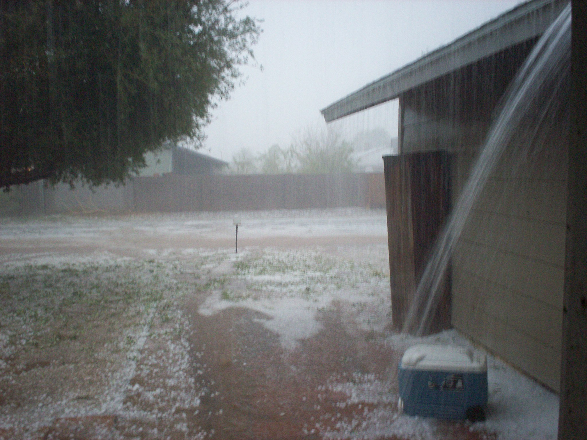
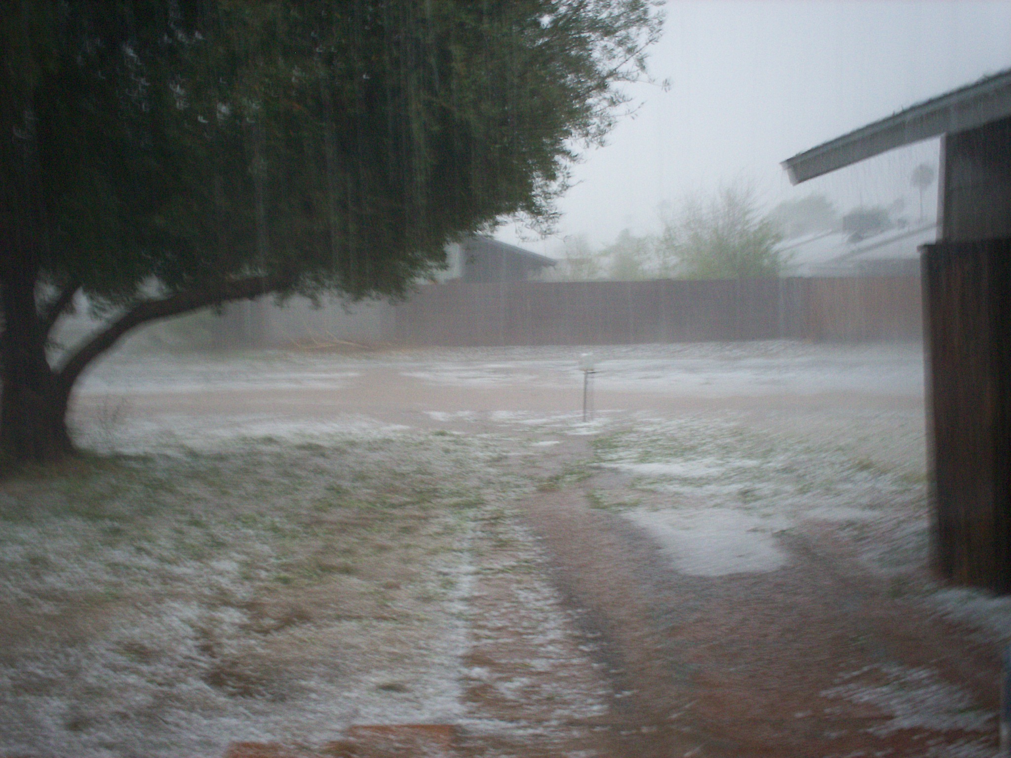
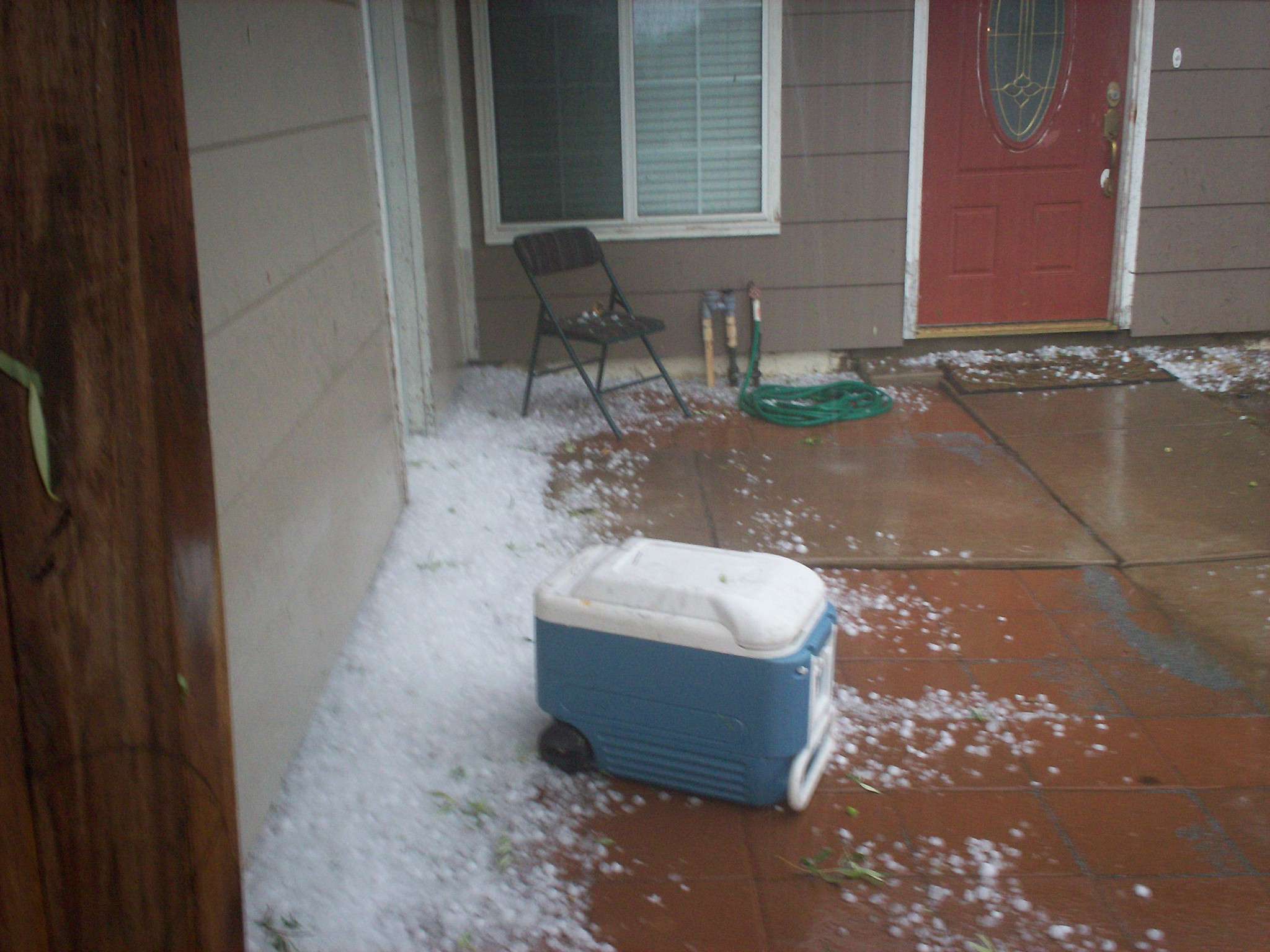
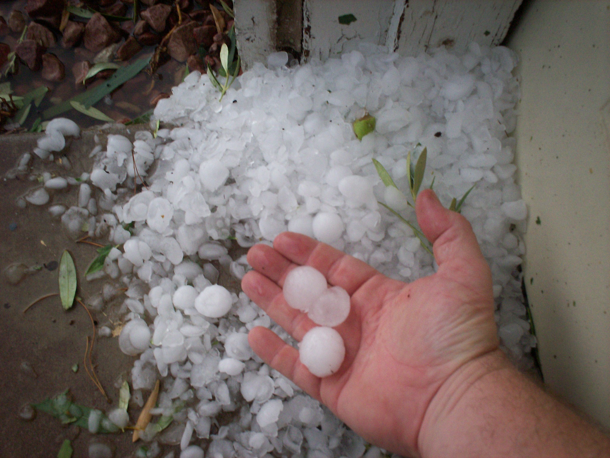
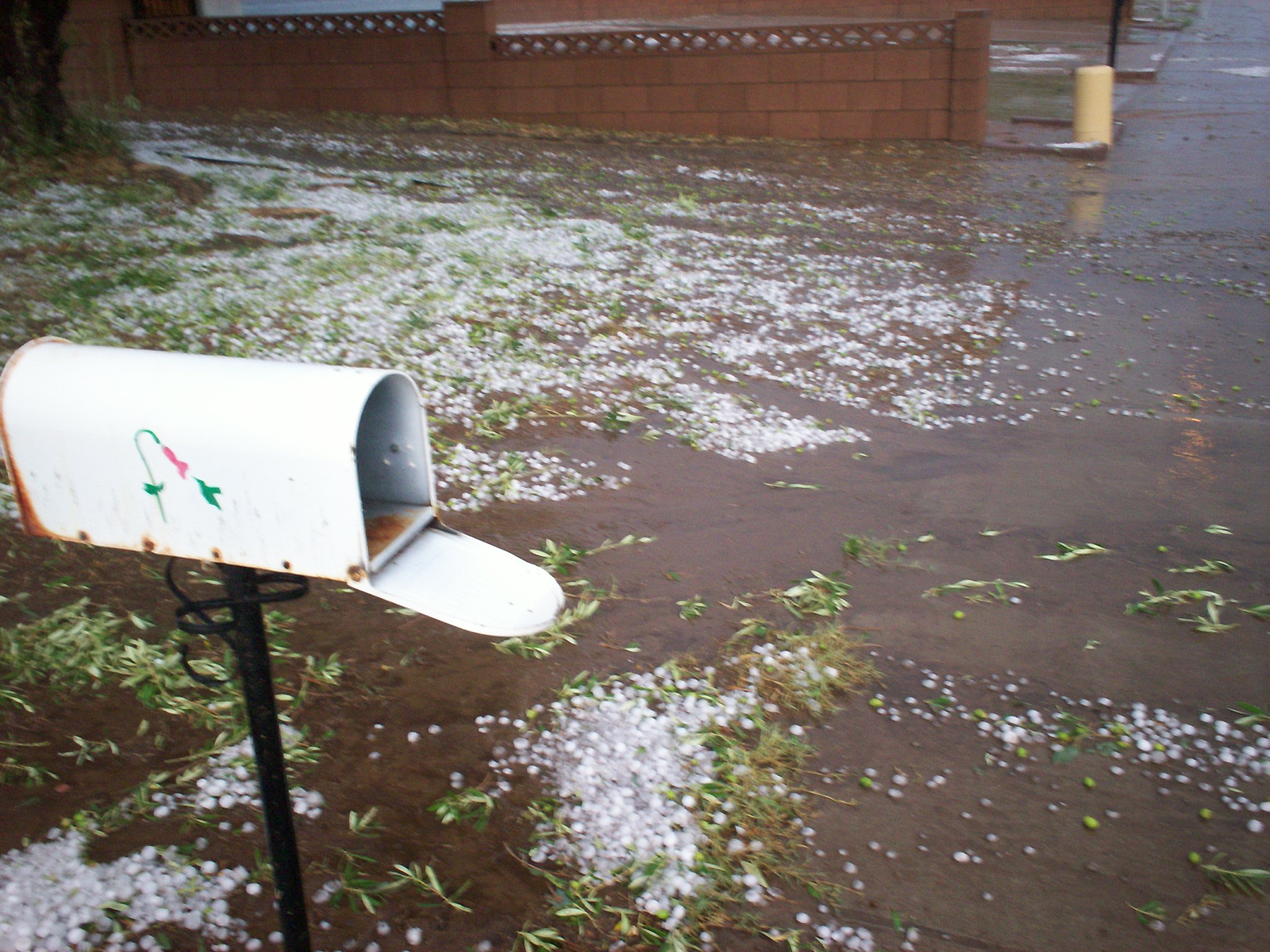
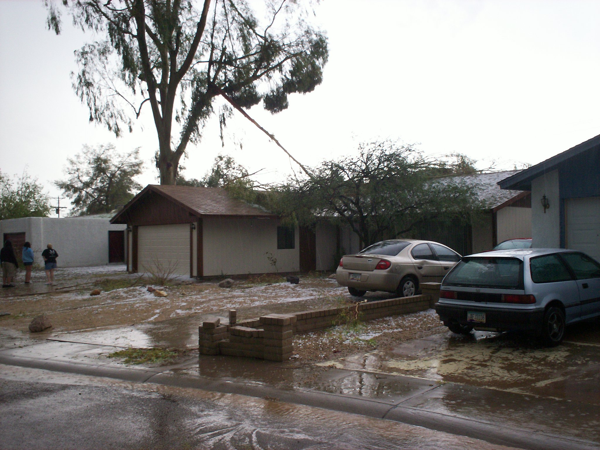
Sounds like the weather I get in Phoenix tracyanne. We just had a hail storm here two days ago. It traveled south to north through the west central part of town with 60mph winds decimating tress and cars and homes with marble to golf ball sized hail, and as hard as pure ice. I am lucky in that I have no significant damage to my home (it took a few years of life off my new roof and I got some hail in through my bathroom vents) but others did not fare so well. My area looks like a DMZ with power lines down and street signals down but only a mile in either direction east or west of me it is as if nothing happened at all. I wont have to pay to have my trees trimmed either, the hail did it for me..its just cleaning at all up that is going to suck. http://lxer.com/pub/files/Scott_Ruecker/000_0007.JPG http://lxer.com/pub/files/Scott_Ruecker/000_0008.JPG http://lxer.com/pub/files/Scott_Ruecker/000_0014.JPG http://lxer.com/pub/files/Scott_Ruecker/000_0019.JPG http://lxer.com/pub/files/Scott_Ruecker/000_0020.JPG http://lxer.com/pub/files/Scott_Ruecker/000_0023.JPG |
Posting in this forum is limited to members of the group: [ForumMods, SITEADMINS, MEMBERS.]
Becoming a member of LXer is easy and free. Join Us!